


Next: Interactive Classes and Devices
Up: Misc Projects
Previous: Scene-Tree
The Project CoordSys is used to enable multiple coordinate systems in the
Scene Tree. These coordinate systems are independent to each other and
independent to the global coordinate system, configured in the trans menu.
The coordinate systems in the scene tree can be saved and loaded using the
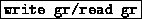 in the manag menu.
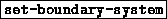
The project will add a coordsys at the current scene tree position and add one
button to the first option menu.
in the manag menu.
The project will add a coordsys at the current scene tree position and add one
button to the first option menu.
-

-
This button is used to open the configuration layer for the specific
coordinate system. The first coordinate system found in the scene tree is
used.
The Configuration layer of the coordinate system allows various options to
configure the coordinate system for your application. Some interactives are
the same for all three directions and are describted only one time.
-

- Configure the coordinate system as a default three
axis coordinate sytem.
-
- Configure the coordinate system as a default
12 axis coordinate system.
-
 ,
, 
- Set the minimum and maximum values in the
specific direction. The coordinate systems axis will last from the minimum
to the maximum value in that direction.
-

- How many mark should be set at the axis in the desired
direction. If a mark is near a crossing of two axises the mark will be
suppressed, but if the value of this mark was visible it will be replaced by
the crossing value.
-

- The name of the axis, which is printed on top of the axis.
The lable will only be show together with the arrow at the end of the axis.
-

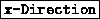
- Open the special configuration layer for the desired
direction. This layer includes the following configuration options:
-

- Enable or disable the different coordinate axis. For
each direction five axis are possible. Four at the position of the minimum
and maximum values in the orthogonal directions. One variable axis
anywhere betweeen these values or even outside.
-
- Enable or disable the marks at the five axis. The axis
obviously must be enabled.
-

- Enable or disable the value printing at some marks and
label output at the top of the axis. The values are only printe if the
marks are enable at the specific axis. The same with the label itself and
the arrow.
-

- Enable or Disable the arrow at the top of the axis. If
the maximum value is lower than the minimum value the arrow will be
printed at the bottom, but will always direct in the maximum direction.
-
 ,
,  ,
, 
- Translate the value
text orthogonal to the axis.
-

- Which of the marks counted from minimum to maximum
value should be the first one with a value given.
-

- How many marks should be skipped while printing
values.
-

- Print format for the value output. Do not include a or a similar format in this field, because this migh crash your program.
-

- Close the expert config layer.
-

- Secify the radius relativ to the axis length of the
longest axis.
-

- Specify the radius of the marks relativ to the
radius of the axis.
-

- The radius of the Arrows relativ to the radius of the
axis.
-

- How much space should be left between the end of
the axis and the beginning of the arrow.
-
 , ,
, ,
- The relativ or
absolute position of the variable coordinate axis in the specific direction.
If any of these values should be an absolute value the button
 in that direction should be enabled.
-

- Number of patches for the axis in rotation
direction. Increase this value if the axis is not smooth enough.
-

- Using this option the end of the axis is rounded
instead of cutted of. Especially a boundary coordinate system will look much
better if you enable this option.
-
- Close the specific configuration layer.
Next: Interactive Classes and Devices
Up: Misc Projects
Previous: Scene-Tree
SFB 256 Universität Bonn and IAM Universität Freiburg Copyright © by the Sonderforschungsbereich 256 at the Institut für Angewandte Mathematik,
Universität Bonn.